The Exploration Centre of the Saudi Geological Survey (SGS) organised a Workshop on Lithium Exploration for a Sustainable Future
Kwesi Apiah of IGS, delivered a presentation on the high-resolution geochemical survey of the Arabian Shield: methods, results, outlook and assessment of its lithium potential. The workshop, organised by the Exploration Centre of the Saudi Geological Survey (SGS), was held in Jeddah on 10 February, 2025. The primary focus was on lithium exploration within the diverse geological environments of the Arabian Shield.
The event featured geoscientific presentations from experts at SGS, IGS (Technical Partner for the Geochemical Sampling Project), King Abdulaziz University, international institutions and industry. The workshop aimed to foster knowledge exchange on lithium exploration, analytical methods, interpretation of results and innovative extraction methods used globally.
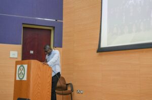
Kwesi Apiah of IGS presenting at the workshop on Lithium Exploration for a Sustainable Future in Jeddah, Saudi Arabia
(For more information please contact us at enquiries@igsint.com)
IGS Attended Mining INDABA in Cape Town, 3rd – 6th February 2025
IGS attended the Mining Indaba 2025 in Cape Town from 3rd – 6th February as part of the UK Government Pavilion. The IGS team included Peter Zawada, Ash Johnson and Frik Hartzer.
Mining Indaba was particularly successful this year based on the many lines of interest shown in IGS from Governments, Geological Surveys, AI/Data companies and the exploration sector.
Many thanks to the UK Trade Delegation for their efforts in making the UK presence in the sector a strong one.

IGS and other UK companies showcasing at the UK Pavilion at INDABA in Cape Town, South Africa.
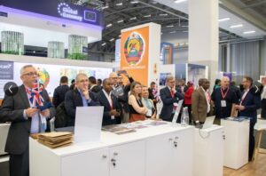
Dr Peter Zawada and colleagues from the other UK companies.
(For more information please contact us at enquiries@igsint.com)
Site visit to United Arab Emirates island
IGS senior specialist geoscientist Dr. Christoph J. Dobmeier took part in a pre-tender site visit on one of the islands of the United Arab Emirates in the Persian Gulf from December 11 to 13. 2024.
The round to elliptical shape of many of the islands gives a direct indication of their geology, as they expose parts of salt-piercement structures. All associated rocks of these structures form the Ediacaran to early Cambrian Hormuz Complex. A characteristic feature is the presence of megaclasts which can reach several 100 m in edge length. Current U-Pb ages indicate that the megaclasts (volcanic, subvolcanic, volcanogenic and detrital sedimentary lithologies) were not detached from younger units as the salt moved toward the surface. Since the ages match that of the salt, they must have been located directly underneath, above, next to or in between it.
The megaclasts are embedded in the so-called Hormuz breccia, a commonly poorly sorted breccia with a very fine-grained maroon matrix composed of gypsum (and/or anhydrite), quartz, and haematite. A slight salty taste indicates the presence of some halite. The almost complete absence of salt, however, was not expected and therefore a very big surprise. It is best explained by salt dissolution during arid weathering. The widespread occurrence of gypcrete (or gypcrust) supports this assumption. Sedimentary rocks of the Holocene Jebal Dhanna Formation rim the salt structure. While the salt structures were emplaced in Miocene time, the displacement of the Holocene rocks suggests that the salt is still or again moving.
IGS would like to thank the UAE Ministry of Energy and Infrastructure (MOEI) and Sharjah Environment and Protected Areas Authority (EPAA) for the invitation and their hospitality during the visit.

Participants of the site visit including IGS senior specialist geoscientist Dr Christoph J Dobmeier (standing, 3rd from right)
(For more information please contact us at enquiries@igsint.com)
IGS Team at FMF25 in Riyadh and Dr Feargal Murphy Speaking at Knowledge Exchange Program in the conference
Dr Feargal Murphy, Principal Geophysicist at IGS, was one of the Knowledge Exchange Program Speakers at a workshop on the first day of FMF25 in Riyadh.
His presentation was on an overview of the SGS (Saudi Geological Survey) RGP airborne Geophysics project in Saudi Arabia and he presented preliminary data examples to demonstrate the hugely increased resolution of the data compared with legacy data. Some of this data is available for free on the National Geoscience Database portal.
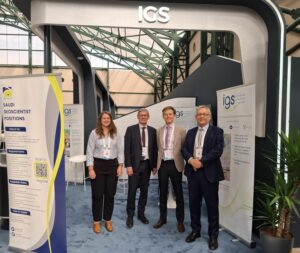
IGS Ltd also turned out in strength for FMF2025 in Riyadh Saudi Arabia. It was great to meet so many clients at the IGS booth. The exhibition continues to grow in size and quality every year and this was reflected in the volume and focused nature of many visitors who visited our booth.
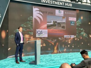
Dr Feargal Murphy speaking at Knowledge Exchange Program workshop during FMF25 in Riyadh
From left Dr. Rowan Vernon, Dr. Ashley Johnson, Dr. Feargal Murphy, Dr. Peter Zawada
(For more information please contact us at enquiries@igsint.com)
Mongolian Mining Week 2024 – MinePro 2024, Quarrying and Mining Exhibition in Ulaanbaatar
Dr. Peter Zawada, IGS Managing Director, attended the Mongolian Mining Week 2024 – MinePro 2024, quarrying and mining exhibition in Ulaanbaatar from 2nd to 5th October 2024.
Peter gave a presentation on ‘Modern government-held geoscience data – a prerequisite for exploration investment decisions’ and was also part of a panel discussion on ‘Consulting services for the mining sector – UK capabilities’.
The UK Department for Business & Trade featured prominently at the exhibition and with the British Embassy in Ulaanbaatar provided excellent support for the trip, arranging the talk/panel discussion and meetings with various stakeholders.
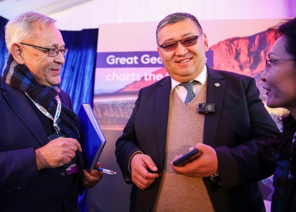
Dr Peter Zawada with Minister Tuvaan of the Ministry of Industry and Mineral Resource
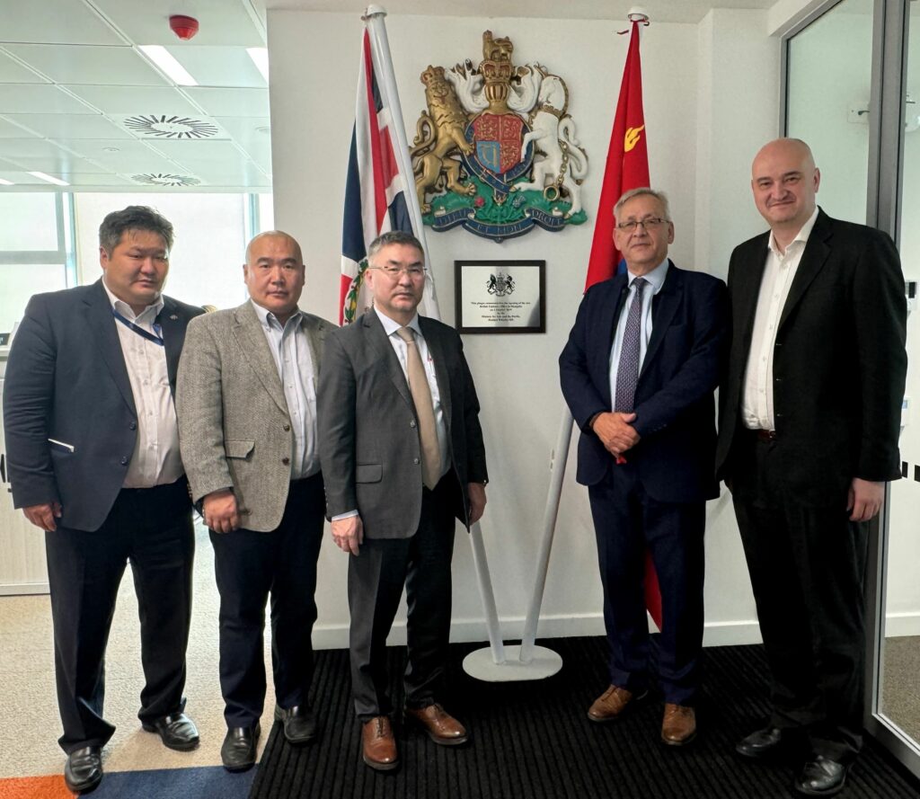
Dr. Peter Zawada with Mr Munkhtur, Director of the National Geological Survey of Mongolia (third from right) and Mr. Benjamin Aldred, UK Deputy Trade Commissioner for Eastern Europe & Central Asia (far right)
By Dr. Peter Zawada – Managing Director
(For more information please contact us at enquiries@igsint.com)
The 6th Uzbekistan International Mining and Metals Forum in Tashkent
Dr. Ash Johnson, IGS Director, recently attended the 6th Uzbekistan International Mining and Metals Forum in Tashkent. As part of the ‘Critical minerals: sources of innovative transition’ panel, he spoke about ‘Modern government geoscience data in the search for critical minerals’, highlighting the role modern data plays in attracting exploration investment into a country.
The highlights of the presentation included examples from the ongoing Regional Geoscience Programme of the Saudi Geological Survey, for which IGS is serving as the Technical Partner in collaboration with GTK, as well as examples from World Bank-funded projects in Nigeria and Uganda in which IGS is also participating.
For more information on how we can help with your regional geoscience projects and the search for critical minerals, please contact us at enquiries@igsint.com).
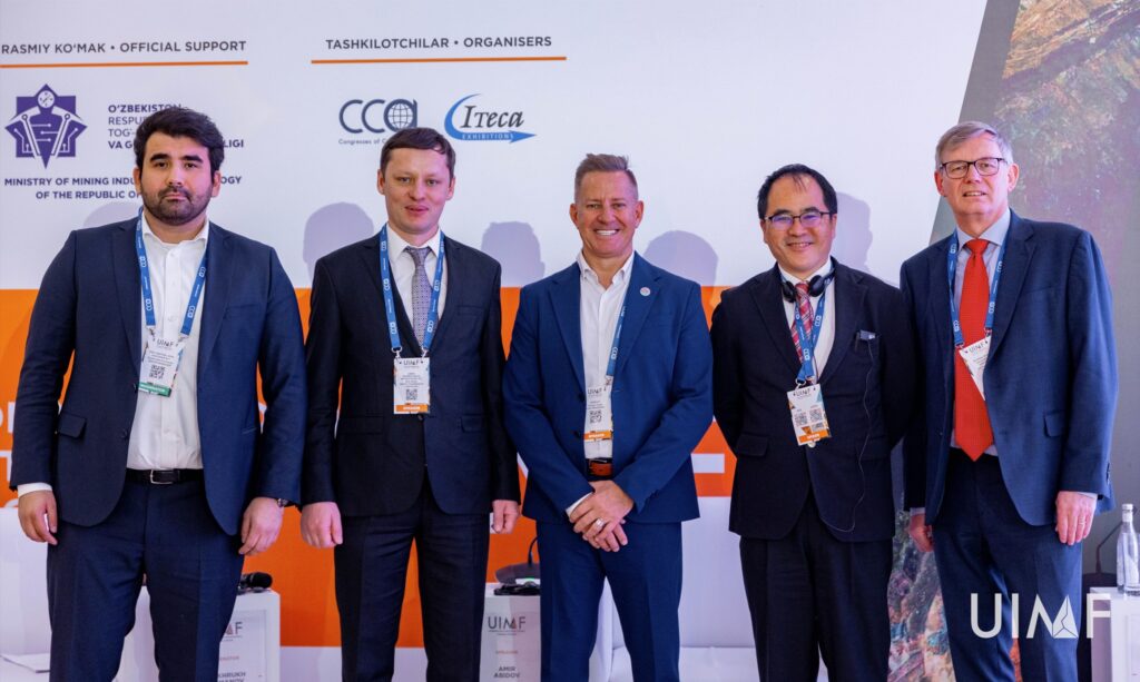
Dr Ash Johnson (far right) with panelists on the ‘Critical minerals: sources of innovative transition’ session of UIMF24, Tashkent, Uzbekistan
Geological Mapping of the Arabian Shield, Saudi Arabia
IGS (International Geoscience Services) Ltd contributes to the largest geological mapping project as leader of the Technical Partner consortium (IGS, GTK, PGW, Geotech Arabia) to the Saudi Geological Survey. One element of support are field inspections during which the quality of the field work is assessed and the quality of the submitted field data is reviewed.
Geologists of the Technical Partner accompany the field activities continuously. The geologists spend part of their time with the field geologists to evaluate their work with a focus on how support and output can be optimized and to make sure that occupational safety is a top priority. Independently, they visit sites to verify geological data collected earlier by field geologists.
The second field season of project Detailed Geological Mapping of the Arabian Shield (GMAS) started in the first days of September 2024. In October 2024, activities focus on the easternmost part of the Arabian Shield between the cities of Al Quwajja, Ad Dawadimi and Bijadiya. GMAS is one of the many initiatives of the Saudi Vision 2030 plan for the Kingdom of Saudi Arabia.
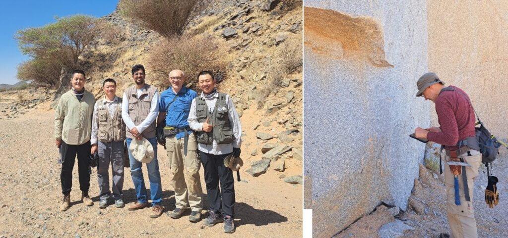
IGS geologist and Team Leader for the GMAS project Christoph Dobmeier (4th from left) with field geologists Tao Bai, Shengwei Wang, Mobarak Al Nadi, and Chao Sun (from left) at the end of a hot field day on map sheet Mughayrā’ (4524-3) and checking field data on sheet Jabal al ‘Ard (4424-2).
By Dr. Christoph J. Dobmeier (EurGeol)– Principal Geologist (for more information please contact us at enquiries@igsint.com)
Xplore Mineral Prospectivity – A Planetary AI and IGS Partnership

Planetary-AI is delighted to announce its partnership with IGS (International Geoscience Services), a leading provider of earth-based intelligence to governments worldwide.
The partnership agreement will see both companies collaborating to deliver cutting- edge target generation for the mineral exploration and mining industry via the Xplore Mineral Prospectivity Platform. Our partnership provides huge opportunities for both companies to expand our mineral targeting capabilities. The partnership agreement will see Planetary-AI expand its services into using Xplore for exploration planning and field-based data acquisition through various geological, geochemical and geophysical surveys. Our new partner, IGS, maintains a high reputation and wealth of experience in the early stages of mineral exploration with governments around the world, and we look forward to working closely with them as we further develop our Xplore software platform.
The Xplore Platform, first developed by IGS, is software that enables geographic targeting of mineral resources based on a plethora of information both geological and topographical. The software’s intelligence is based on over fifty (50) mineral deposit types that are found all around the world, which are dependent on factors such as geology, structure, age, mineralogy and specific spatial geological relationships. Xplore has been significantly enhanced through a major re-development project over the last 18 months. It is unique in comparison to other types of mineral targeting software as it is underpinned by proven geological mineral deposit intelligence from experts combined with an array of artificial intelligence technologies, to enable the machine to ‘Think like a Geologist’.
Planetary AI is pleased to announce that it will soon start a major project for Botswana Diamonds, using the Xplore platform to analyse the companies’ vast datasets with the goal of yielding fresh insights and to identify new drillable targets. The Chairman of Botswana Diamonds, John Teeling, commented:
“Our mineral database in Botswana is simply vast. Too big for timely analysis by humans. Think of it, over 375,000 kms of geophysical data, and 32,000 drill holes logs. Massive databases are suited to analysis by computer-based large Data Models and Artificial Intelligence techniques which can analyse substantial amounts of data in a short time. An added exciting bonus for BOD and for Botswana is that the technique will analyse a number of different minerals. We have always believed that there are more diamond deposits to be found under the sand. Now there is the possibility of other deposits being identified”.
For more information on Planetary AI see (http://planetary-ai.space)
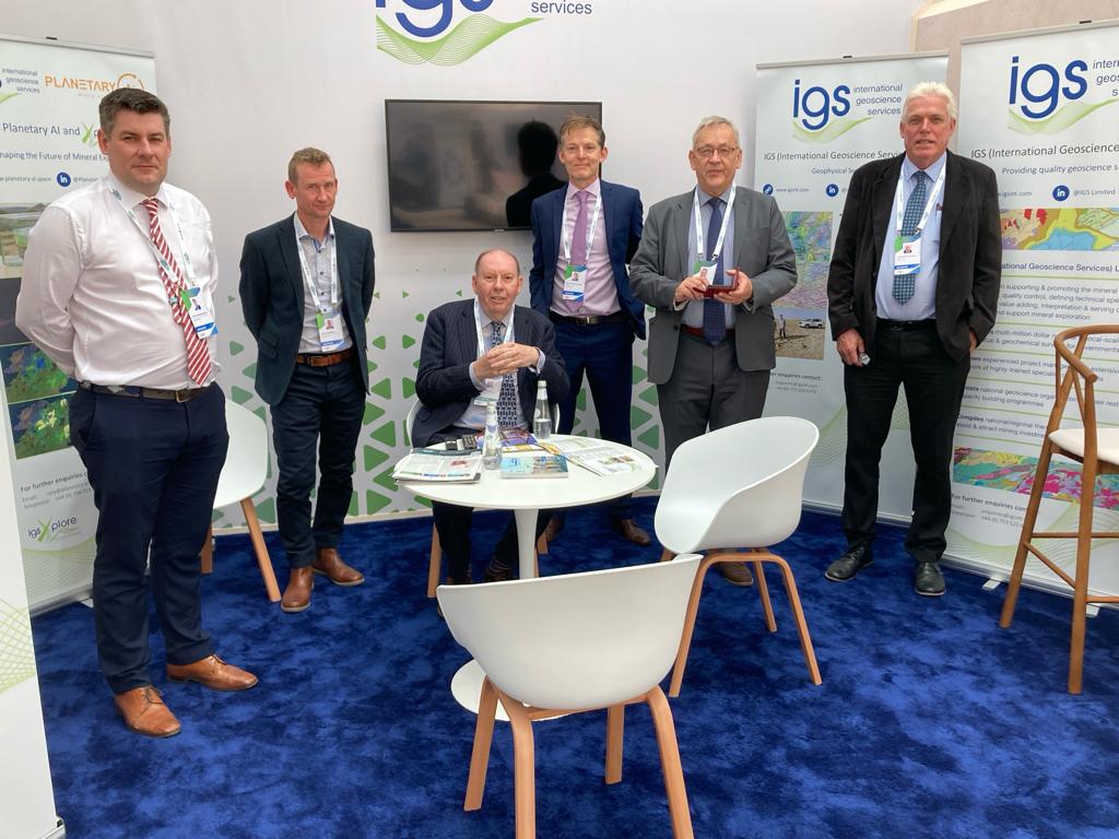
Planetary AI and IGS exhibiting at the Future Minerals Forum, Riyadh, January 2024
By Rory Somerset (Planetary AI)
(For more information please contact us at enquiries@igsint.com)
IGS and Partner PGW Perform Geophysical Data QA/QC in Nigeria and India
Recently, Dr. Feargal Murphy and IGS partner PGW performed QA/QC on geophysical data in Nigeria. The project for Mindiver (Mineral Sector Support For Economic Diversification) is coming to a close and IGS (with partners PGW) has performed QA/QC of the final acquisition and interpretation products.
The acquisition was completed this week and a total of 1.56 million line km of magnetic gradiometry and radiometric data was acquired by Xcalibur since the project commenced in late 2021.
On another ongoing project, IGS in collaboration with IDPEX partners PGW and Datacode, have begun QA/QC of a magnetic/radiometric fixed wing survey flown by McPhar/Xcalibur for the Geological Survey of India in the state of Gujarat. This latest survey covers block 15 of the GSI’s ongoing national airborne geophysics acquisition program.
By Dr. Feargal Murphy – Principal Geophysicist
(For more information please contact us at enquiries@igsint.com)
IGS Attends PDAC 2024 in Toronto
It was great to attend PDAC from the 3rd – 6th March 2024 in Toronto. The event proved again to be a success for IGS in meeting clients and establishing discussions on some exciting new opportunities for the company.
PDAC (Prospectors & Developers Association of Canada) is the World’s Premier Mineral Exploration & Mining Convention. It is the leading event for people, companies and organizations connected to mineral exploration.

By Dr. Peter Zawada – Managing Director
(For more information please contact us at enquiries@igsint.com)
