Our News blog
Featured Blog
Category: News
The Geological Institute of Ethiopia and the FDRE Ministry of Mines invited IGS for Mintex 2025
The geological institute of Ethiopia and the Federal Democratic Republic of Ethiopia (FDRE) Ministry of Mines invited IGS to present at Mintex 2025 on the multi-sector applications of regional airborne geophysics.
The many insightful questions reinforced the importance of expanding pre-competitive geoscience data in Ethiopia—especially across the Neoproterozoic terranes and regions with high geothermal potential.
Dr. Feargal Murphy of IGS was pleased to attend and contribute to such an engaging conference and trade show. The range of topics — from mineral policy and legal frameworks to artisanal mining, new exploration activity, and recent mine developments — made for an informative and productive event.
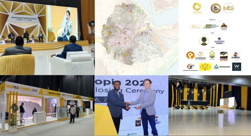
Dr. Feargal Murphy presenting at Mintex 2025
(For more information please contact us at enquiries@igsint.com)
Category: News
Dr Feargal Murphy presentation to experts from Arabian Shield Stratigraphic Commission
Dr Feargal Murphy recently presented initial results from SGS RGP airborne geophysics phase 1 (mag/rad) to experts from Arabian Shield Stratigraphic Commission (ASSC) group. The ASSC is a panel of international experts in Neoproterozoic geology who are developing an updated lithostratigraphy for the upcoming Arabian Shield mapping programme. The RGP phase 1 data is being acquired for SGS by Sander Geophysics Ltd and Xcalibur Multiphysics. IGS and colleagues from Patterson Grant and Watson (PGW) are technical advisors for the RGP geophysics programmes. IGS and GTK are technical partner for the RGP programme.
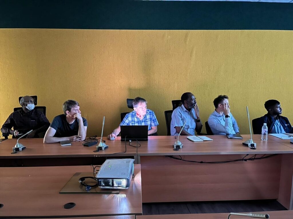
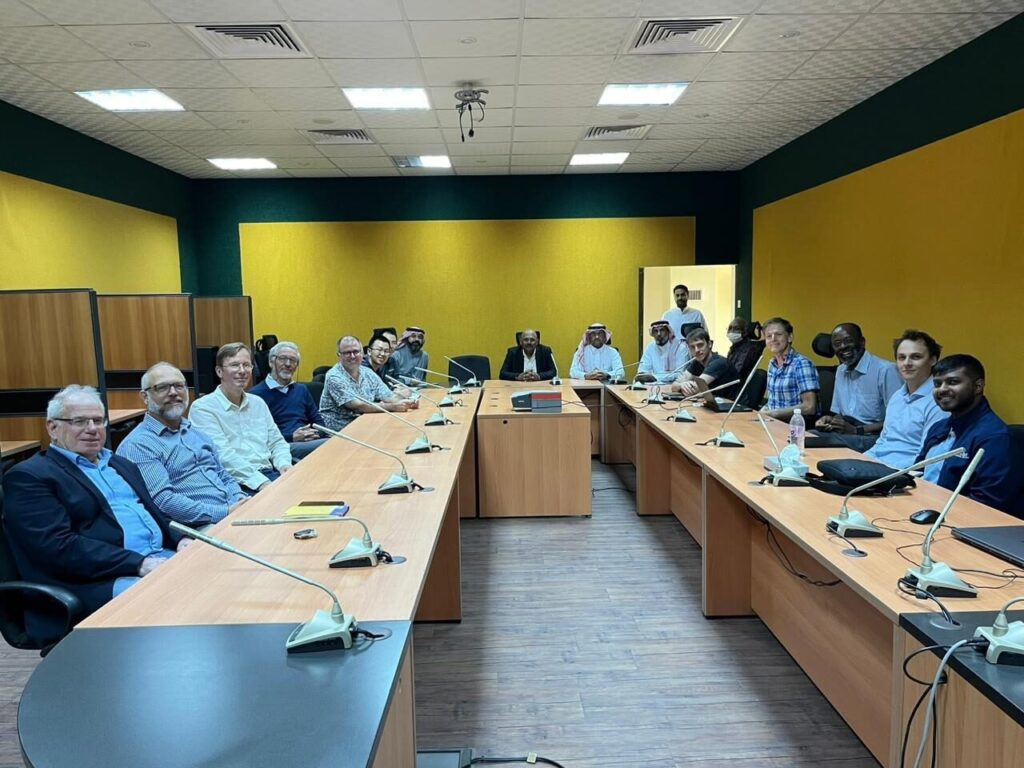
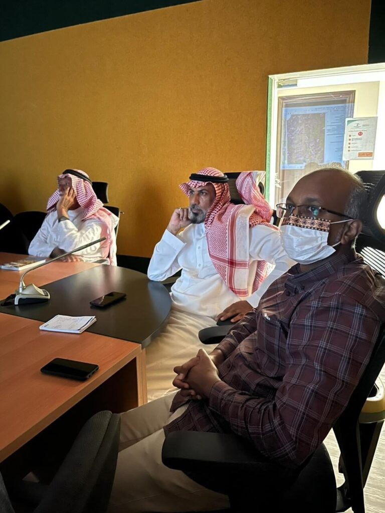
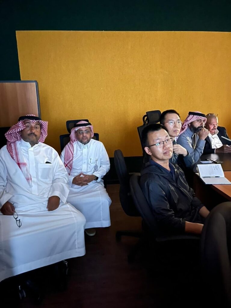
By Dr. Feargal Murphy – principal geophysicist
(For more information please contact us at enquiries@igsint.com)
Category: News
IGS in Suriname – A roadmap for a new Geological Survey
IGS and GAF AG (Germany) are together working on a 12-month long project commissioned by the Suriname Ministry of Natural Resources entitled: ‘International mining specialist to support the establishment & the commissioning of the Minerals Institute of Suriname: Cadastre & Geological Survey’. This is one of several initiatives of a loan agreement between Suriname and the World Bank called the ‘Suriname Competitiveness and Sector Diversification Project’.
Suriname has an interesting geology with much of it located on the Guiana Shield, which has a high potential for a range of minerals including gold, diamonds, other metallic minerals as well as kaolin, critical minerals (including rare earth elements) and dimension stone. The extractive sector of Suriname is dominated by oil, gold and bauxite. The government wants to promote a regulated and responsible expansion of its mining industry by creating a new mining authority known as ‘Delfstoffen Authoriteit Suriname’, whose objective will be the promotion, coordination, regulation, monitoring and inspection of its mineral sector in a sustainable manner. Our project supports these objectives by developing a modernised mining cadastre and a new Geological Survey.
IGS is responsible for the development and early-stage implementation of a road map for a new Geological Survey. An important component of the work will be to identify the key geoscience and geodata programs that will attract investor interest in the country. GAF AG is responsible for the assessment and development of a road map for the implementation of a revised and modernised cadastre system. Both IGS and GAF AG have visited the country as part of the inception phase and are now working on the assessment part of the project for these components. Further updates for this project will be posted as the project progresses.
(For more information please contact us at enquiries@igsint.com)
Category: News
Dr. Feargal Murphy at Dawadmi airport to inspect survey Aircraft Systems and Radiometric Calibration range – KSA Project
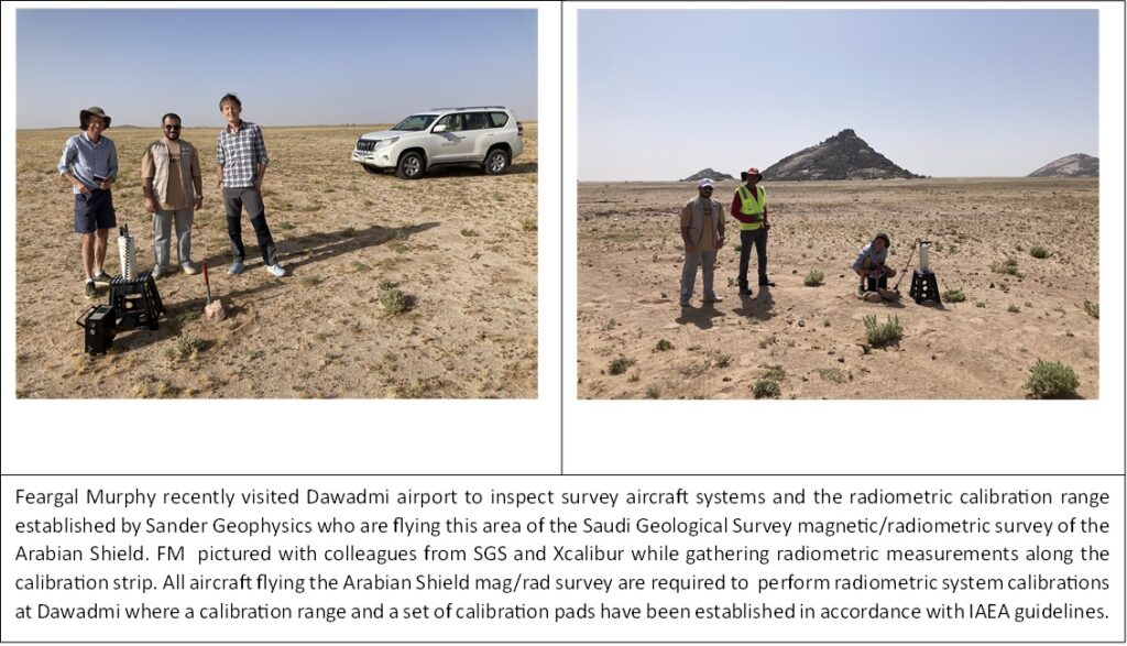
On another note, IGS has continued to perform quality control on the MINDIVER airborne geophysics program in Nigeria. IGS is sub-contracted by PGW of Toronto. IGS geophysicists have recently completed quality control of ~190,00 line kms of airborne magnetic/radiometric data.
By Dr. Feargal Murphy – principal geophysicist
(For more information please contact us at enquiries@igsint.com)
Category: News
Geological Mapping of the Arabian Shield – Opening Ceremony
IGS and its partners are honoured to have attended the official opening ceremony of the Arabian Shield Geological Mapping (GMAS) project. The event took place near Jeddah on Sunday May 28th 2023. The official launch of the project was marked by speeches from the Minister of Industry and Mineral Resources, Bandar Alkhorayef and the Chairman of the Chinese Geological Survey, Li Jianxing. Many geologists from the Saudi Geological Survey, the contractor (China Geological Survey) and the Technical Partner (IGS-GTK Consortium) attended the ceremony.
For the GMAS project, IGS as lead Technical Partner is the official technical adviser for the Saudi Geological Survey and is responsible for the supervision and quality control. For more information see : https://www.arabnews.com/node/2312236/business-economy
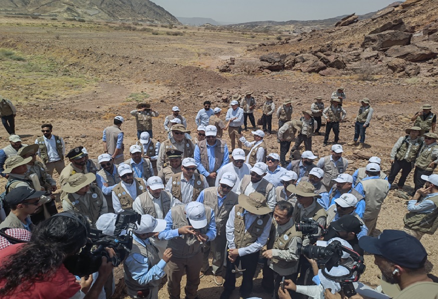
Geologists from the Saudi Geological Survey (SGS), Chinese Geological Survey (CGS) and the Technical Partner (TP) as part of the official opening ceremony of the Geological Mapping project of the Arabian Shield, Saudi Arabia.
By Dr. Reik Degler – Project Geologist
(For more information please contact us at enquiries@igsint.com)
Category: News
Kick-off meeting for the Geological Mapping Program of the Arabian Shield
IGS as leader of the Technical Partner Consortium to the Saudi Geological Survey participated in the Kick-off meeting (KOM) for project Geological Mapping of the Arabian Shield, which is part of the Regional Geoscience Program (RGP), executed under the leadership of the Saudi Geological Survey. The meeting, which was organized by the contractor China Geological Survey (CGS) and its logistics partner China National Geological & Mining Corporation (CGM), took place from 19-21 March 2023 at Aliaa Swissotel Living Hotel in Jeddah with some 50 delegates from seven nations.
With 15 presentations, the contractor explained how the 11-year project should be implemented. The objective is to improve the geological knowledge of the Arabian Shield, which covers some 650,000 square kilometers, by generating a new set of geological maps. 257 maps at a scale of 1:100,000 are required. The maps will be based on new geological field surveys (undertaken at a scale of 1:50,000) including analytical work, the results of currently operational airborne geophysical and ground-based geochemical (stream sediment) surveys, an updated lithostratigraphic framework, and legacy data.
IGS is responsible for the supervision of all works and quality control of all products of project Geological Mapping of the Arabian Shield.
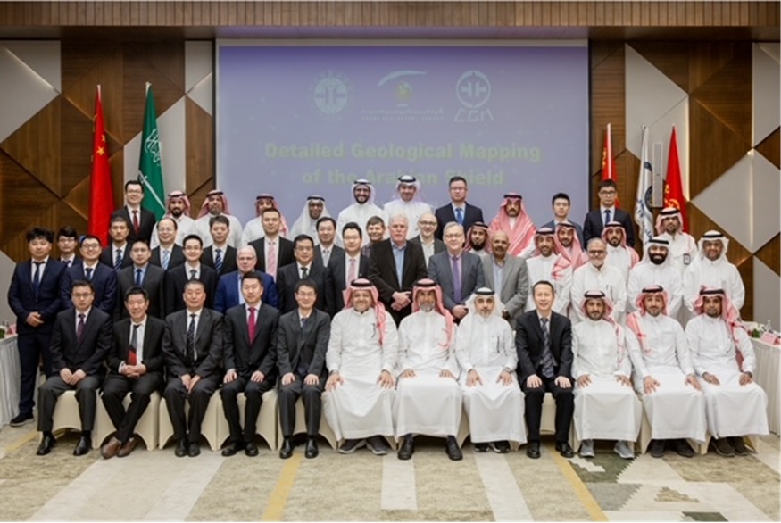
Group photo of KOM delegates. The CEO of SGS, Engineer Abdullah bin Muftar Al-Shamrani sits in the centre of the bottom row, flanked by the project owner Dr Wadee Kashghari (left) and Engineer Abdulrahman Al Hawi (right, SGS Vice President for Initiatives and Strategic Projects). To his right sits the leader of the CGS team Dr Wenhua Ji. The IGS team consisting of Drs Gerrit de Kock, Frik Hartzer, Christoph Dobmeier, and Peter Zawada can be seen in the centre of the photo.
By Dr. Christoph Dobmeier – principal geologist
((For more information please contact us at enquiries@igsint.com)
Category: News
Airborne Geophysical Survey and Geological/Geochemical Mapping of Karamoja, Uganda
After an interruption of a year due to security concerns, field work for the geological mapping and the geochemical survey, resumed in February 2023, in the Karamoja region. IGS is the official partner of the Directorate of Geological Survey and Mines (DGSM) in collaboration with PGW and is responsible for controlling the quality of all project related activities. The mapping and the geochemical sampling are conducted by field teams contracted by Xcalibur Multiphysics and the DGSM. In close cooperation with IGS experts and its partner, target areas were determined using the latest geophysical data and legacy field data. The results of the geology and geochemistry for the Karamoja region will be of great assistance in the future exploration of mineral resources.
Due to security-related issues, IGS conducts much of its quality control and review of project deliverables, remotely.
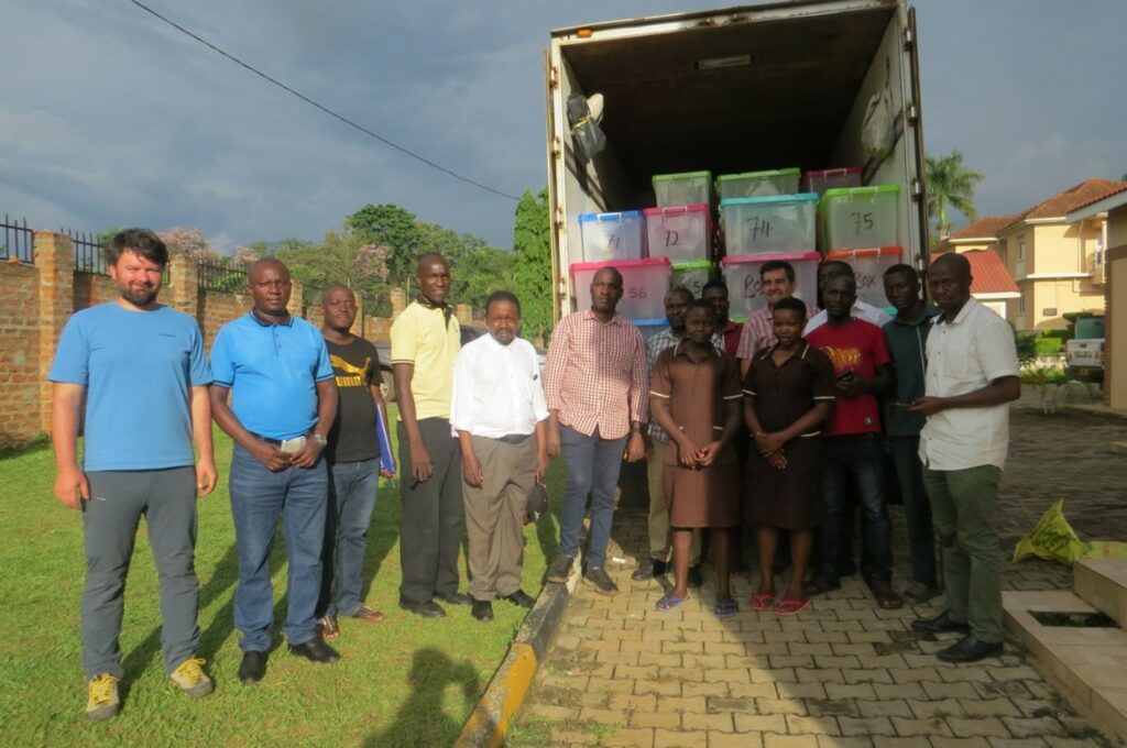
A joint exercise in Mbale (Eastern Uganda) between the client (DGSM), the contractor (Xcalibur Multiphysics) and the quality controller (IGS/PGW) where stream-sediment and bulk-rock samples were inspected and transported to the preparation laboratory in Entebbe. The truck contains samples from the first of nine zones that were successfully sampled, with more to follow. After processing in Entebbe, the samples are sent to a commercial laboratory for multi-element analysis.
(For more information please contact us at enquiries@igsint.com)
Category: News
IGS as Technical Partner of the Saudi Geological Survey in the RGP Geophysics project
IGS (International Geoscience Services) geophysicists continue to carry out quality control and provide technical advisory services to SGS (Saudi Geological Survey) for the Regional Geoscience Program (RGP) Phase 1 geophysics which consists of magnetic gradiometry and radiometrics flown at 300m line spacing over the entire Arabian Shield.
Sander Geophysics is flying Block 1 while Xcalibur is currently flying in Block 3. Both blocks are approaching 50% completion and some final products have been generated for completed portions . There are now 7 aircraft on the project and > 700,000 line kms flown to date. IGS and partners have also assisted the Saudi Geological Survey with developing scope of work for future airborne acquisition phases comprising targeted surveys (e.g. electromagnetics) over areas prospective for mineral deposits.
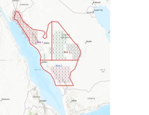
Arabian Shield Phase1 blocks
By Dr. Feargal Murphy – principal geophysicist
(For more information please contact us at enquiries@igsint.com)
Category: News
IGS Exhibits at Mining Indaba 2023
IGS was privileged to showcase the company and its services at the large UK Department for International Trade (DIT) stand at Mining Indaba, Cape Town, 6th to 9th February 2023. We received a lot of interest and enquiries with Indaba this year being better attended and having more of a ‘buzz’ than 2022. Certainly, and as always, it was a pleasure to meet up with clients, partners and colleagues.
Dr. Peter Zawada (MD) gave a presentation at the DIT stand entitled ‘Increasing Nation States competitively in the Mineral Sector’. Dr. Ash Johnson (COO) and Dr. Frik Hartzer (Senior Project Manager) of IGS also attended Indaba. It was particularly pleasing to meet up with Government Ministries and Geological Survey officials from across the world under one roof.
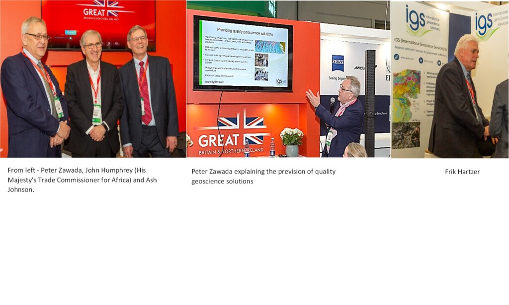
(For more information please contact us at enquiries@igsint.com)
Category: News
Saudi Geological Survey
The Saudi Geological Survey have announced the launch of a new committee that brings together international geological experience from the Saudi Arabia, the US, Australia, Europe and China to take a modern look at structures across the Saudi part of the Arabian-Nubian shield.
Luke Stannard process Manager at Resolve Mining Solutions | Board Member of the Australia Saudi Business Council indicated that some regions have not seen review for over 50 years. He said he has often come across reports that appear to need a new eye cast over them and this will lead to a few new discoveries/interesting exploration programs.
Below is Dr. Christoph Dobmeier – principal geologist at IGS (International Geoscience Survey) Ltd and two colleagues from the Saudi Geological Survey.
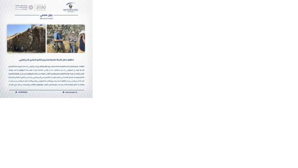
(For more information please contact us at enquiries@igsint.com)
Category: News
IGS as Technical Partner of the Saudi Geological Survey in the GSAS project
The High-Resolution Geochemical Survey of the Arabian Shield (GSAS) project which covers the entire Arabian Shield (c. 600,000 km²), commissioned by the Saudi Geological Survey (SGS) and conducted by the Chinese Geological Survey (CGS) is currently in its second sampling phase.
Since GSAS started at the end of 2021, the project has been making great strides. More than 48 000 stream sediment samples have been successfully collected and progressed by the contractor. The first analytical results are expected in the coming month. The project will have a duration of six years with the sampling and collection of approximately 100,000 sediment samples which will be completed in the first three years.
In its role as the official Technical Partner of the SGS, IGS experts supported by geochemists from the Finish Geological Survey (GTK), advise the client and undertake the quality control of the following project stages: planning, sampling, sample preparation, chemical analysis, data quality, geochemical databasing, statistical analysis of data, interpretation, and geochemical map production.
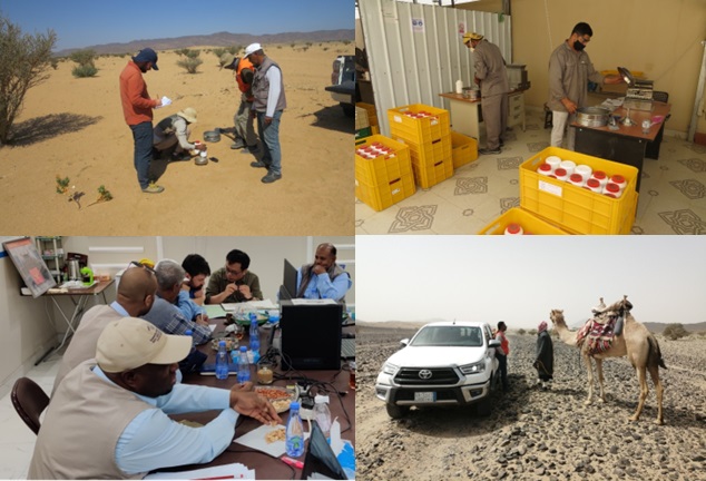
By Dr. Reik Degler – Project Geologist
(For more information please contact us at enquiries@igsint.com)
Category: News
IGS completes Mozambique mapping project
On schedule, IGS, together with its partners BRGM, Gondwana and PGW, completed a mapping project in north-eastern Mozambique with the delivery of ten geological maps at a scale of 1:50,000 and the accompanying sheet explanations in two volumes for the geology and the mineral resources.
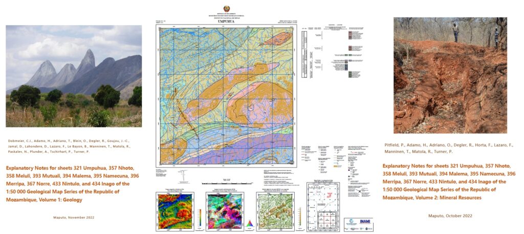
The approved products were passed on to INAMI (Instituto Nacional de Minas) on 11 November 2022.
The project was undertaken within the World Bank-financed Mining And Gas Technical Assistance Project (MAGTAP). Work included the acquisition and compilation of historical data, the interpretation of airborne geophysical data, the compilation of 25 preliminary geological maps, geological mapping of approximately 7,500 km2, inspection and cataloguing of all resource, the assessment of the resource potential, laboratory work (thin sections, whole rock analyses, age determination) and the production of ten geological maps and their accompanying GIS databases at a scale of 1:50000. Furthermore, five sheets of the Geological Map Series 1:250 000 were revised to incorporate the results of the survey.
(For more information please contact us at enquiries@igsint.com)
Category: News
IGS consortium wins major contract in India
IGS Ltd, as part of IDPeX Pvt Ltd, has signed an agreement with the Odisha Mineral Exploration Corporation Ltd (OMECL) of India to optimise the exploration of mineral deposits in the eastern Indian State of Odisha. This will result in an inventory of auctionable blocks of different minerals.
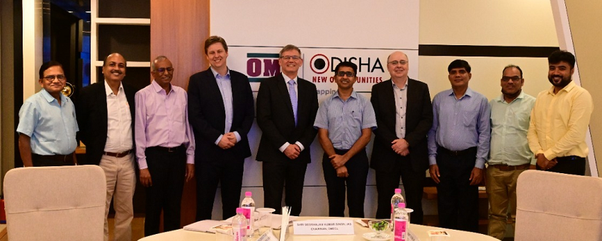
IDPeX Pvt Ltd is the Indian registered joint venture of IGS Ltd, Datacode International (Pvt) Ltd, and Paterson, Grant & Watson Ltd (PGW). On this project IDPeX is working with consortium partners MSA Group Pty Ltd.
The work program will manage legacy data from exploration agencies of the State of Odisha. New airborne geophysical surveys will follow resulting in the selection of potential mineral blocks for different mineral commodities. The exploration programme will use the latest technologies and adhere to international standards.
Shri D.K. Singh, IAS, Chairman, OMECL said that, “Odisha is a mineral rich state. However, a large part of the State is still unexplored. This exploration program will lead to the discovery of hidden mineral deposits across the state using the latest technology which will help the state to utilise the mineral resources for the development of the State.”
Dr Ash Johnson, Director of IDPeX Ltd said “We are honoured and excited that IDPeX and MSA have been selected by OMECL as their Strategic Technical Consultant for this project. Our knowledgeable local team will work alongside our international experts to deliver auctionable blocks suitable to attract additional domestic and international investment into the State of Odisha.”
